Trail Walking Nivigne et Suran - signal Nivigne - Photo
© OpenStreetMap contributors
Length
Length
14 km
Max alt
Max alt
766 m
Uphill gradient
Uphill gradient
735 m
Km-Effort
Km-Effort  
24 km
Min alt
Min alt
358 m
Downhill gradient
Downhill gradient
739 m
Boucle
Boucle
Yes
Creation date :
2019-04-27 11:22:38.644
Updated on :
2019-04-27 11:22:38.644

(0 Reviews)

Walking
Walking
4h51
Difficulty : Unknown

Scan this QR Code to open this trail in the SityTrail application

FREE GPS app for hiking

Logo SityTrail SityTrail

IGN / Geographical institutes

Download SityTrail from the App Store Download SityTrail from Google Play

Logo SityTrail SityTrail World

The world is yours!

Download SityTrail from the App Store Download SityTrail from Google Play Download SityTrail on Huawei AppGallery

About

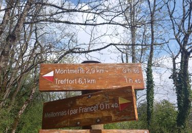
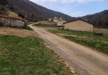
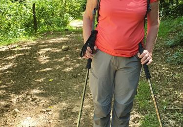
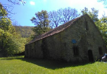
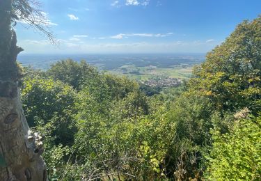
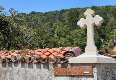
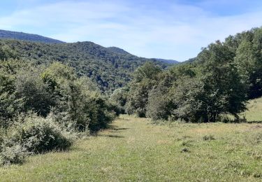
Trail Walking of 14 km to be discovered at Auvergne-Rhône-Alpes, Ain, Nivigne et Suran. This trail is proposed by mamirtine.

Elevation profile

Positioning

Country:
France
Region :
Auvergne-Rhône-Alpes
Department/Province :
Ain
Municipality :
Nivigne et Suran
Location:
Chavannes-sur-Suran
Start:(UTM)
684790 ; 5128560 (31T) N.

Trails nearby

Trail Walking Corveissiat - arnans abbay de selignac - Photo
Walking
loca.yves

Walking

Easy
Corveissiat, Auvergne-Rhône-Alpes, Ain, France
11 km | 15.7 km-effort
3h 11min
Yes
Trail Walking Val-Revermont - chapelle des conche.depart de montmerle et son observatoire  - Photo
Walking
colomb24

Walking

Very difficult
Val-Revermont, Auvergne-Rhône-Alpes, Ain, France
18.1 km | 24 km-effort
5h 8min
Yes
Trail Walking Nivigne et Suran - chavane sur suran la grotte de l ours - Photo
Walking
colomb24

Walking

Very difficult
Nivigne et Suran, Auvergne-Rhône-Alpes, Ain, France
19.4 km | 28 km-effort
7h 31min
Yes
Trail Walking Val-Revermont - Mont Myon-Revermint - Photo
Walking
janussity

Walking

Medium
Val-Revermont, Auvergne-Rhône-Alpes, Ain, France
7 km | 11.3 km-effort
2h 8min
Yes
Trail Equestrian Val-Revermont - paque2019 - Photo
Equestrian
reve

Equestrian

Very easy
(1)
Val-Revermont, Auvergne-Rhône-Alpes, Ain, France
20 km | 24 km-effort
Unknown
No
Trail Walking Nivigne et Suran - Dhuys-Cuisiat - Photo
Walking
Bogapuki

Walking

Medium
Nivigne et Suran, Auvergne-Rhône-Alpes, Ain, France
18.1 km | 28 km-effort
6h 25min
Yes
Trail sport Val-Revermont - Reverront - Photo
sport
hl44lv

sport

Very easy
Val-Revermont, Auvergne-Rhône-Alpes, Ain, France
12.9 km | 18.3 km-effort
Unknown
Yes
Trail Walking Val-Revermont - Cuisiat, Pouillat, Nivigne, Rosy, col des justices - Photo
Walking
Praff

Walking

Difficult
Val-Revermont, Auvergne-Rhône-Alpes, Ain, France
21 km | 34 km-effort
6h 39min
Yes
Trail On foot Val-Revermont - Nivigne Cuisiat - Photo
On foot
Praff

On foot

Medium
Val-Revermont, Auvergne-Rhône-Alpes, Ain, France
15.2 km | 26 km-effort
5h 48min
Yes


Close
My subscriptions